
Arizona Hunt Unit 4B Map – Exploring Rim Country’s Hunting, Hiking & Lakes
- ADVENTURE iDIAZ

- Sep 30, 2025
- 9 min read
Arizona Hunt Unit 4B lies along the Mogollon Rim with deep canyons, Rim lakes, and northern grasslands. It’s known for elk, deer, pronghorn, trout fishing at Chevelon and Willow Springs Lakes, and scenic hikes along Rim Road. A diverse slice of Arizona high country worth exploring.

Arizona Hunt Unit 4B stretches north from the Mogollon Rim, covering a striking mix of conifer forests, rim canyons, pinyon-juniper country, and northern grasslands. Its southern edge drops steeply toward Chevelon Creek and the Rim lakes, while its northern end flattens into open pronghorn country. Wildlife diversity is what makes 4B stand out—elk, deer, pronghorn, turkey, and bear all find their place here.
Hunters, hikers, and anglers gravitate to this unit for different reasons: bugling elk in September, trout-filled lakes in summer, or quiet canyon hikes that reveal just how rugged Rim Country really is. Understanding the terrain—from tank-studded flats to canyon bottoms—is key to making the most of your time in 4B.
Historical & Geographic Overview of Arizona Hunt Unit 4B
Unit 4B’s southern boundary follows the Mogollon Rim, tying into Chevelon Creek and several high-country lakes, while the northern edge stretches toward the Little Colorado River country near AZ-77. This spread of elevations explains the range of habitats—towering ponderosa pine and fir in the south, breaking into pinyon-juniper hills, and finally leveling out into grassland in the north.
These shifts in vegetation and topography matter: they shape where elk, deer, and pronghorn travel, where hunters focus their glassing, and where anglers and hikers discover hidden corners. Rim Country has long been a hub for outdoor use—from early ranching and logging operations to today’s mix of recreation and hunting seasons.
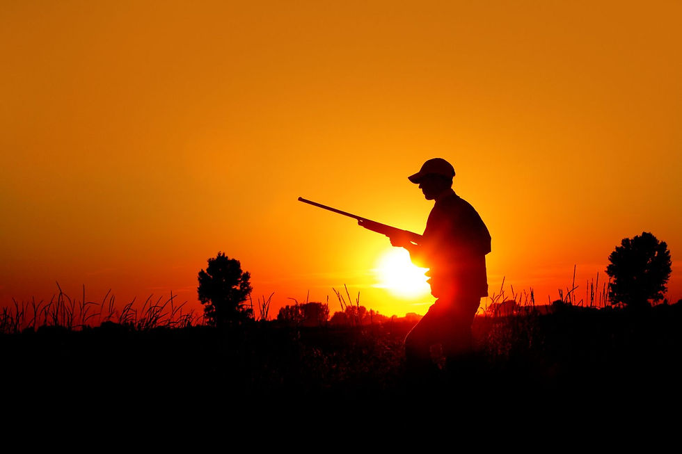
Hunting in Arizona Hunt Unit 4B
Hunting in Unit 4B is shaped by the land itself. From the steep Mogollon Rim canyons in the south to the open grasslands in the north, each habitat band holds a different challenge and reward. The southern country offers thick timber where elk bugle through September mornings, while the broken canyon edges hide mule deer and the occasional Coues deer. Northward, pronghorn (antelope) graze the wide-open flats where visibility is both a blessing and a challenge for stalks.
This unit is popular with hunters because of its diversity. You can spend the morning glassing Rim-country elk, switch gears to scout deer trails along the canyon benches, and still have time to check pronghorn waters before sundown. The variety keeps things fresh, but it also means scouting is key—knowing where animals concentrate, how they move with the seasons, and what water sources they rely on can make the difference between a long hike and a filled tag. Be sure to confirm tag availability, draw odds, and season structures with the Arizona Game and Fish Department (AZGFD) before planning your hunt, since regulations can shift year to year.
Antelope (Pronghorn)
Pronghorn occupy the northern grasslands and open pinyon-juniper flats. Long-range optics, patience, and careful stalks are necessary in this wide-open habitat. Tanks and small water sources often become reliable focal points during dry spells.
Black Bear
Bears are found in the canyons and mixed-conifer forests along the Rim. Fall hunts are the most productive, when mast crops, berries, and acorns draw them into specific drainages. Spot-and-stalk hunters should key in on green patches and creek bottoms.
Elk
Elk thrive in 4B’s southern canyons and benches, moving between the thick timber and more open meadows. The rut in September is a highlight, with bugles echoing across canyon country. Scouting benches, saddles, and waterholes helps narrow down where herds are moving.
Mountain Lion
Mountain lions are present throughout the unit, especially in areas with steady deer activity. Look for sign along canyon benches, creek drainages, and tank approaches. Hunters often locate lions by tracking or calling in predator-rich zones.
Deer
Mule deer are most common in the broken PJ country and canyon rims, while small numbers of Coues deer hold closer to the Rim’s southern edges. Early morning glassing sessions along saddles, rim fingers, and canyon heads are effective.
Merriam’s Turkey
Merriam’s turkeys inhabit the mixed conifer forests of the Rim. Spring hunts provide gobbling action, while fall hunters find birds feeding in open meadows and along creek bottoms.
Javelina
Javelina favor the lower elevations and brushy foothill zones of 4B, often traveling in family groups. Hunters should glass for movement near water and look for rooting sign in PJ flats.
Tree Squirrel
Kaibab and Abert’s squirrels add small-game variety, particularly in the ponderosa pine forests. Fall hunts overlap with big-game seasons, giving hunters another opportunity during mid-day hours.
Hiking, Backpacking & Fishing in Unit 4B
Unit 4B isn’t just for hunters—it’s also one of the most rewarding parts of Rim Country for hikers, campers, and anglers. Trails cut along the Rim’s dramatic edge, lakes sparkle in high pine forests, and quieter canyon routes lead into rugged backcountry. Whether you’re chasing trout, looking for a weekend base camp, or hiking to panoramic overlooks, this unit delivers plenty of options within its boundaries.
Top Hiking Trails in Unit 4B
Rim Lakes Vista Trail #622 — Short and easy, this trail offers big payoffs with sweeping views right along the Mogollon Rim. Excellent for sunrise or sunset hikes.
General Crook Trail #140 — A historic trail following the route of General Crook’s supply road. It parallels the Rim and combines history with great forest scenery.
Trail #535 — A moderate trail through ponderosa pine country, connecting Rim Road (FR 300) to scenic overlooks and forest routes.
One Eighty Trail #409 — A tougher climb that links Rim viewpoints with backcountry stretches. Good for hikers looking for a challenge and solitude.

Camping Options
Camping in 4B offers everything from lakeside family spots to quieter Rim overlooks. Many of these are managed by the U.S. Forest Service, Apache–Sitgreaves National Forests, with both developed and rustic sites available:
Spillway Campground — Perched on the eastern shore of Woods Canyon Lake, this small campground is popular with anglers and paddlers. Sites fill quickly in summer, thanks to direct lake access, shaded pine forest, and cool Rim-country air.
Crook Campground — Tucked in pine forest near Woods Canyon Lake, a quieter option with historic ties to General Crook.
Rim Campground — Perched along FR 300, this site delivers breathtaking Rim-edge views and quick access to nearby trails.
Sinkhole Campground — Located near Willow Springs Lake, family-friendly with easy lake access for fishing and boating.
Larson Ridge Camping Area — A dispersed camping area in the Apache-Sitgreaves National Forest off FR-237, accessible by dirt road, offering primitive campsites with vault restrooms. This spot is quieter than the busy Rim-lake campgrounds, especially when roads are dry, but expect rough access and limited services (no potable water or hookups).
Fishing Waters
Fishing is one of Unit 4B’s biggest draws, with Rim Country waters that range from stocked family lakes to rugged canyon creeks.
Chevelon Canyon Lake & Creek — Known for trophy-class trout, best accessed by hike-in or high-clearance vehicle routes.
Willow Springs Lake — A large, popular lake stocked with rainbow and brown trout; easy access and great for families.
Woods Canyon Lake — Well-developed facilities, boat rentals, and consistent trout fishing make this one of the most popular spots in the Rim area.
Best Times to Visit Unit 4B
Unit 4B offers something unique in every season. Spring brings mild temperatures, blooming wildflowers, and active wildlife, making it a great time for turkey hunts and early trout fishing. Summer is busy at the Rim lakes but provides a cool escape from the desert heat, perfect for camping and family trips. Fall is considered the prime season, when elk bugles echo through the canyons, bears feed heavily, and crisp weather makes for comfortable days outdoors. Winter snows close many Rim roads, yet those who make the trip find a quiet landscape where solitude comes easy.

Local Tips for Exploring
Visitors to Unit 4B will quickly learn that the easiest spots often draw the biggest crowds. By hiking just beyond the first mile, you can often leave most of the traffic behind and experience a more secluded setting. Water sources such as springs, tanks, and creek beds are essential for both wildlife and backcountry travel, so keeping them in mind when planning your day pays off. Rim Road (FR-300) is as scenic as it is slow, with dust, washboards, and pullouts that demand extra travel time—carry spare gear, water, and a good paper map to stay prepared.
Sightseeing & Scenic Drives with the Arizona GMU 4B Map
Unit 4B isn’t just about hunting—it’s also home to some of the most rewarding drives and overlooks in Rim Country. Rim Road (FR-300) winds along the Mogollon Rim, offering breathtaking vantage points into canyons and forests below. Stops like Woods Canyon Vista showcase sweeping views southward, especially at sunrise and sunset. For something closer to the water, pullouts at Willow Springs and Woods Canyon Lakes provide picnic spots and photo-worthy views in a more relaxed setting.
Watch the Arizona Hunt Unit 4B Map Overview Video
FAQs About Arizona Hunt Unit 4B
What elevation ranges should hunters and hikers prepare for in Unit 4B?
Elevations run from about 5,500 feet along Chevelon Creek to nearly 8,000 feet on the Mogollon Rim. These shifts affect vegetation, temperatures, and wildlife movement, so be ready for cooler Rim air, hotter flats, and demanding canyon hikes.
How does weather affect hunting in Unit 4B?
Summer monsoons can muddy roads, while fall cold fronts push elk and deer downslope. Winter storms often close Rim Road (FR-300). Always have backup routes and gear for changing conditions.
Are there predator hunting opportunities in Unit 4B?
Yes. Mountain lions follow deer, and black bears feed in Rim canyons during fall. Javelina and tree squirrels provide additional small-game opportunities. Check AZGFD regulations for current rules.
How crowded does Unit 4B get during peak seasons?
Elk seasons in September and October bring the most hunters. Summer crowds cluster around Woods Canyon and Willow Springs Lakes. Midweek visits or lesser-used forest roads help you find solitude.
What animals can you hunt in Unit 4B?
Species include antelope, black bear, elk, mountain lion, mule deer, Coues deer pockets, Merriam’s turkey, javelina, and tree squirrels. Habitat use ranges from elk in Rim canyons to pronghorn on northern flats.
Where can you fish in Unit 4B?
Top spots are Chevelon Canyon Lake & Creek, Willow Springs Lake, and Woods Canyon Lake. Chevelon is rugged and hike-in, Willow Springs suits small boats, and Woods Canyon offers the easiest access with rentals and steady stocking.
What are the best hiking trails in Unit 4B?
A:Highlights include Rim Lakes Vista Trail #622, General Crook Trail #140, Trail #535, and One Eighty Trail #409.
What are the best campsites in Unit 4B?
Spillway, Crook, Rim, Sinkhole, and Larson Ridge Campgrounds are the most popular, covering everything from lakeside fishing bases to Rim overlooks and rustic canyon camps.
How do I get an Arizona Game Management Unit 4B Map?
Order directly from ADVENTURE iDIAZ. Our tear- and water-resistant 1:100k map highlights roads, trails, waters, and terrain specific to Unit 4B.
Why Buy Our Arizona GMU 4B Map
Navigating Unit 4B takes more than guesswork. From the rugged hike into Chevelon Canyon Lake to the maze of forest roads near Woods Canyon, having an accurate, durable map makes all the difference. Our Arizona GMU 4B Map is designed specifically for this unit, highlighting the roads, trails, waters, and recreation features that matter most. Whether you’re chasing elk in the Rim canyons, glassing pronghorn on the northern flats, or camping lakeside with family, this map gives you the clarity and confidence to make the most of your time outdoors.

More Roads & Water Sources — Displays more roads, tanks, creeks, and springs than any other map, giving you crucial options when scouting or in the field.
Trails & Recreation Areas — Marks hiking paths, campgrounds, and recreation corridors so you can plan trips that mix hunting, fishing, and sightseeing.
Easy-to-Read Layout — Clean labeling and intuitive symbols help you find your way quickly, whether in dense timber or open country.
Durable Construction — Built with tear-resistant and water-resistant material to withstand rough Arizona conditions.
Compact Scale — At 1:100k, it balances broad coverage with enough detail for precise navigation.
Detailed Topographics — Clear contour lines and elevation shading help you anticipate travel routes, bedding areas, and glassing knobs.
Recreation Highlights — Identifies campgrounds, picnic areas, lake access points, and scenic overlooks.
Full-Color Quality — Professionally printed for sharp detail and vibrant colors that hold up in the field.
Get Your Arizona GMU 4B Map Today
Arizona GMU 4B is one of the most diverse game management units in Rim Country. Elk in the canyons, pronghorn on the flats, mule deer along the rim edges, and trophy-class trout in the lakes make it a destination for hunters, anglers, and hikers alike. With roads, trails, and waters spread across such varied terrain, navigation is everything. Our Arizona Hunt Unit 4B Map brings clarity and confidence to your trips, keeping you focused on the hunt, the hike, or the cast—not on second-guessing your route.


Comments