
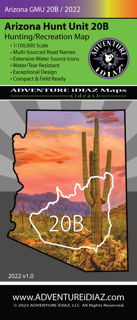
Arizona Hunt Unit 20B Map – Elk, Antelope & Canyon Country Adventure
- ADVENTURE iDIAZ

- Oct 7, 2025
- 10 min read
Updated: Oct 18, 2025
Arizona Hunt Unit 20B is more than lines on a map—it’s where desert washes meet mountain ridges, and history lingers in ghost towns and backroads. From Wickenburg’s Hassayampa corridor to the rugged Bradshaw slopes and the north arm of Lake Pleasant, this unit draws hunters, hikers, anglers, and sightseers alike. Exploring it with an accurate Arizona Hunt Unit 20B Map makes the difference—revealing the roads, creeks, and trails that tie these landscapes together.

Historical & Geographic Overview of Arizona Hunt Unit 20B
Arizona Hunt Unit 20B is a place where desert legend and mountain grit collide. The lower end of the unit near Wickenburg has always been a crossroads—first for the Yavapai people, who lived along the Hassayampa River’s precious water, then for prospectors chasing gold and silver in the 1800s. Wickenburg itself became one of the West’s richest gold strikes, and trails from that era still thread into the canyons of the Hassayampa River Canyon Wilderness.
Many of the rough dirt routes hunters and hikers use today were carved by mule teams hauling ore, and the ghost towns of Bumble Bee and Cleator still echo with saloon and mining camp stories. Crown King, perched high in the Bradshaws, remains an iconic mountain town where history feels alive—its Crown King Saloon has served travelers since the 1800s.
Geographically, Unit 20B is a study in contrasts. At its lowest, near Lake Pleasant, saguaros and palo verde line the washes; quail flush from mesquite thickets, and anglers launch boats in search of striped bass. Climb north into the Castle Creek Wilderness or Hells Canyon Wilderness, and the landscape changes to sharp volcanic ridges, rocky canyons, and solitude that tests even seasoned backpackers. Push higher still toward Horsethief Basin and the pines around Crown King, and you’re in another world—cooler air, trickling creeks, and trails that invite long hikes or backcountry camps.
For outdoorsmen of every stripe, the diversity here is the hook. Hunters use elevation changes to follow mule deer and javelina. Hikers and backpackers lace together desert and mountain trails for multi-day treks. Anglers chase both warm-water species in the lake and panfish in the mountain ponds. And for sightseers, the scenic drives—like the rugged Crown King Road or the desert-to-pine climb of Constellation Road—offer an open-air history lesson in Arizona’s frontier past.
Unit 20B’s character lies in that blend of history, geography, and opportunity. It’s a place where you can start a day walking through saguaro flats and end it sipping a cold drink in an old mining town 6,000 feet higher. Whether you’re glassing for deer, hiking to a wilderness overlook, or just chasing a sunset along Castle Hot Springs Road, this unit delivers more than maps and terrain lines—it delivers stories you can step into.
Hunting in Arizona Hunt Unit 20B
Hunting in Unit 20B is a study in contrasts—you can glass desert ridges lined with saguaros in the morning and be hiking into oak-and-pine country above Crown King by evening. This unit is shaped by its water sources, and success often comes down to how well you read them. Mule deer bucks slip between rocky desert washes and mid-elevation benches, while javelina pack together in prickly pear flats, rooting noisily where hunters often overlook them. Dove and quail concentrate around tanks and the Hassayampa corridor, especially in the early season when food and water are in demand. Higher up, the thick chaparral and north-facing canyons create pockets of cooler cover that hold game long after the lower desert warms up. Add in Lake Pleasant’s waterfowl, occasional bears on the Bradshaw slopes, and lions tailing deer across the rocky spine, and you’ve got one of the most diverse hunting landscapes in central Arizona. The Arizona Game and Fish Department (AZGFD) manages the hunts here, balancing opportunity with conservation—so whether you’re chasing mule deer, glassing for javelina, or working a covey of quail, their guidelines shape how hunters experience 20B. Our Arizona Hunt Unit 20B Map brings it together—roads, tanks, creeks, springs, and contour detail—so you can plan your hunts with the kind of accuracy that actually pays off in the field.
Mule Deer: Country, Patterns & Glassing
Country: Desert palo verde–cactus up through chaparral and pinyon-juniper; look for broken slopes, saddles, and benches near water/tanks.
Approach: Dawn/dusk glassing into shadowed faces; still-hunt mid-elevation fingers; use our 1:100k contours to plan ridge-to-ridge glassing and quiet sidehill routes.
Notes: After opening pressure, bucks slide into steeper, brushier cuts—especially where road density drops.
Javelina: Habitat & Tactics
Habitat: All over 20B, densest 2,500–4,500 ft in thorny cover. Work prickly pear flats, hedgehog and barrel cactus stands, and rimrock pockets above wash bottoms.
Approach: Midmorning glassing for feeding bands; track fresh rooting and scat near water and green up after late-summer storms.
Upland & Waterfowl: Where & When
Dove/Quail: Desert flats and mesquite/palo verde belts; flyways on the Hassayampa and Agua Fria corridors and around stock tanks, especially north/south of Hwy 74 (Carefree Hwy).
Waterfowl: Coves at the north end of Lake Pleasant (access off Table Mesa when open). Always check current rules/restrictions before heading in.
Black Bear & Lion (Selective Opportunity)
Bear: Limited, but possible in higher, rougher pockets with oak mast, manzanita, and springs. Focus on the coolest north slopes and remote basins.
Lion: Travel edges on deer movement corridors; glass rocky bowls above saddles and water.
Hiking, Backpacking & Fishing with Your Arizona GMU 20B Map

Exploring 20B on foot is like moving through three different worlds in a single day. The saguaros and mesquite of the desert floor give way to volcanic canyons and chaparral ridges, before finally opening into the pines around Horsethief Basin. The Arizona GMU 20B Map and U.S. Forest Service (Prescott National Forest) guides make sense of this patchwork, pointing you toward trailheads, campsites, and waters that might otherwise stay hidden. Whether you’re hiking a stretch of the Black Canyon Trail, pitching camp near Crown King, or casting a line at Lake Pleasant, this unit rewards those who wander.
Top Hiking Trails in Unit 20B
If you’re strapping on boots in 20B, you’ll find everything from Sonoran desert singletrack to cool mountain loops. Here are three standout trails worth putting on your list:
Black Canyon National Recreation Trail (Bumble Bee segments) – Iconic Sonoran-to-Bradshaw singletrack, with rolling desert scenery and sweeping mountain views. Best hiked in cooler months; trailheads near Bumble Bee make for great out-and-backs.
Arrastra Creek Trail #275 (Horsethief Basin / Crown King area) – Rugged 8.6-mile route climbing through chaparral and pine, rewarding with solitude and backcountry flavor. Pair it with nearby loops for longer treks.
Governors Peak (Hells Canyon Wilderness) – A quieter trail into the Hieroglyphic Mountains, offering big sky views and desert solitude. Pack water—this is true wilderness.
Backcountry Campsites & Dispersed Camping Options
Camping in Unit 20B is as diverse as the terrain. From full-service campgrounds on the lake to primitive spots tucked deep in the Bradshaws, here’s where you can set up your base:
Developed Backcountry / Park Campgrounds:• Desert Tortoise Campground (Lake Pleasant) – Lakeside tent and RV sites with easy shoreline access.• Roadrunner Campground (Lake Pleasant) – Larger, developed campground with amenities close to the water.• Turney Gulch Group Campground (Horsethief Basin) – USFS group site tucked into the cool Bradshaws; a solid base for hunting or hiking.
Dispersed Options:• Hells Canyon Wilderness – Primitive, no services, just open desert backcountry for those who want quiet nights under the stars.• Prescott NF roads near Crown King/Horsethief Basin – Common dispersed sites where hunters and backpackers set up off the beaten path.• Note: Always double-check land status—20B includes patches of private/state trust land and active mining claims.
Fishing in Arizona Game Management Unit 20B: Lakes, Streams & Access
If your trip includes a rod and reel, Unit 20B delivers two distinct fishing experiences—big water at Lake Pleasant and a hidden gem in the high country:
Lake Pleasant (north end in 20B): A premier fishery with striped bass, largemouth bass, catfish, and crappie. Shoreline access and boat launches give multiple entry points.
Horsethief Basin Lake (near Crown King): Small, peaceful lake tucked in the pines. Great for shore fishing, with a mix of panfish, catfish, and historically stocked tiger muskie. Ideal for pairing a morning hike with an afternoon cast.

Best Times to Visit Unit 20B
Timing your trip to 20B can make the difference between a brutal slog and a memorable adventure. Summer bakes the saguaros but keeps the high-country ridges cool; fall brings the hunts into full swing; spring lights up the desert in wildflowers. Hunters, hikers, and anglers all plan around these shifts, making the right season as important as the right gear. Every Arizona unit has its quirks, and 20B is no exception. Rough roads, sudden weather, and scattered private inholdings can turn a perfect outing into a headache if you’re not prepared. Knowing how locals tackle Crown King Road or where to find reliable water access makes all the difference—and your map and planning will back you up when surprises come.
Access & vehicles: Crown King Road is long, rough; Castle Hot Springs Road can be sandy/flooded.
Lake Pleasant: Check Maricopa Parks & AZGFD for access rules, especially waterfowl.
Land status: Mix of private, state trust, and mining claims—always confirm before setting up.
Local Tips Section Intro
Every Arizona unit has its quirks, and 20B is no exception. Rough roads, sudden weather, and scattered private inholdings can turn a perfect outing into a headache if you’re not prepared. Knowing how locals tackle Crown King Road or where to find reliable water access makes all the difference—and your map and planning will back you up when surprises come.
Access & vehicles: Crown King Road from Bumble Bee is long, rough, and narrow in places—high-clearance recommended; check weather before you go. Castle Hot Springs Road is scenic but can have sandy/flash-flooded sections. Drive smart.
Lake Pleasant hunting/fishing: Parts of the north end have specific access rules and seasonal updates—check Maricopa County Parks and AZGFD before launching or setting up a waterfowl spread.
Land status: Patches of private/state trust land and active mining claims exist in 20B; AZGFD recommends pre-season scouting and respecting posted areas.
Sightseeing & Scenic Drives with the Arizona GMU 20B Map
Not every trip into 20B needs a tag or a backpack. This unit is also built for explorers who want open-air history, big sky views, and rugged backroads. From the mining camps along Constellation Road to the high climb into Crown King, every drive is part scenic tour, part time machine. Bring your Arizona GMU 20B Map and let the roads lead you where stories still echo.
Crown King Road (Bumble Bee → Crown King): Saguaro desert to pines, past ghost towns.
Constellation Road (Wickenburg side): Mining relics, access to Hassayampa River Canyon Wilderness.
Castle Hot Springs Road (north of Lake Pleasant): Desert backroad with scenic views.
Watch the Arizona Hunt Unit 20B Map Overview Video
FAQs About Arizona GMU 20B
How does elevation change in Unit 20B affect hunting strategies?
Because 20B stretches from Lake Pleasant’s desert floor to pine ridges above Crown King, animals shift elevation with temperature and pressure. Early hunts often succeed in lower flats; later in the season, deer and javelina slide into higher, cooler chaparral and oak pockets.
What are the biggest access challenges in Unit 20B?
Rugged roads like Crown King Road and Castle Hot Springs Road can wash out during monsoon storms. State trust land and mining claims also block routes. Always verify access before a hunt, and expect high-clearance or 4x4 vehicles.
Are predators like lions or bears a realistic factor in Unit 20B?
Yes, but selectively. Black bears stay in higher Bradshaw slopes where mast crops grow, while mountain lions use deer corridors throughout the unit. Hunters often cut lion tracks on ridges above tanks or in rocky saddles.
What unique opportunities does Lake Pleasant add for hunters and anglers?
The north arm of Lake Pleasant sits squarely in 20B, providing rare overlap of big-game hunting and fishing. You’ll find coves for waterfowl, shoreline access for striped bass or catfish, and staging areas where dove and quail fly at first light.
Where can backpack hunters base camp for multi-day trips?
Two standout areas: dispersed sites near Horsethief Basin in the high Bradshaws, and primitive pockets along the Black Canyon Trail near Bumble Bee. Both offer water proximity, ridge access for glassing, and enough distance from vehicles to cut pressure.
What’s the biggest mistake hunters make in 20B?
Underestimating terrain and access. Many assume “close to Phoenix” means easy hunts. In reality, steep ridges, brush-choked canyons, and limited water require careful scouting. Successful hunters spend serious time glassing ridgelines, checking tanks, and monitoring roads.
How do seasonal water patterns impact wildlife movement in 20B?
Water drives everything here. In dry spells, game concentrates around man-made tanks and springs. After monsoon storms, animals spread out into washes and flats. Knowing which tanks actually hold year-round often makes the difference between an empty day and success.
What are the best non-hunting activities to enjoy in Unit 20B?
Beyond hunting, 20B offers excellent hiking, camping, and fishing. Visitors hike the Black Canyon Trail, explore ghost towns like Cleator, camp at Lake Pleasant or Horsethief Basin, and fish for bass or catfish. Scenic drives like Castle Hot Springs Road deliver desert and mountain views.
Is Unit 20B family-friendly for camping and outdoor recreation?
Yes. Lake Pleasant’s developed campgrounds (Desert Tortoise and Roadrunner) provide family amenities, while Crown King’s high-country sites offer cooler summer escapes. Families enjoy picnicking, boating, fishing, hiking, and stargazing. Wilderness areas like Hells Canyon are more rugged and better for experienced adventurers.
Why Buy Our Arizona GMU 20B Map
When you’re chasing mule deer across cactus flats, glassing rugged Bradshaw ridges, or fishing the north end of Lake Pleasant, the right map makes all the difference. Our Arizona GMU 20B Map isn’t just another paper fold-out—it’s a field-tested tool designed to show you more roads, more water, and more terrain detail than any other option. Built tough, easy to read, and loaded with practical data, it’s the map serious hunters and outdoor adventurers trust.
More Roads & Water Sources – More tanks, springs, creeks, and access roads than any other map.
Trails & Recreation Areas – Clear identification of hiking paths, camping access, and nearby recreation corridors.
Easy-to-Read Layout – Clear symbology and intuitive design.
Durable Construction – Tear- & water-resistant, built for rugged field use.
Compact Scale – 1:100k balance of detail and coverage.
Detailed Topographics – Contours and relief for planning glassing and routes.
Recreation Highlights – Campgrounds, trailheads, scenic overlooks included.
Full-Color Quality – Vibrant, high-contrast printing.
Get Your Arizona GMU 20B Map Today
From Lake Pleasant’s coves and Hassayampa canyons to Crown King’s ridges, Unit 20B rewards anyone who plans access and water carefully. Equip yourself with the Arizona Hunt Unit 20B Map—more roads & water, clearer terrain, and rugged, field-ready durability. Order yours and hunt smarter this season.


Comments